Market Spotlight: Downtown Land Values…60 Years Ago
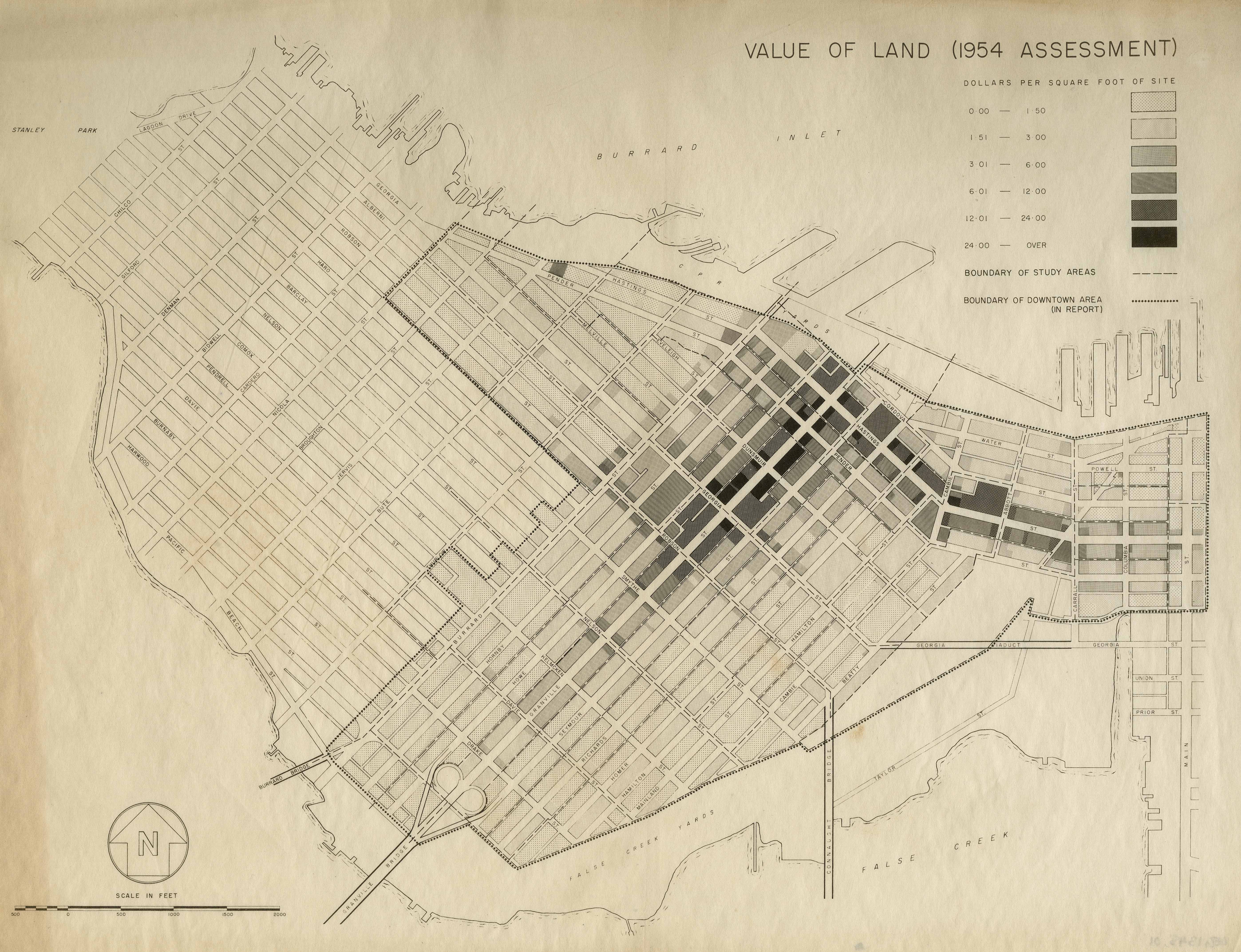
Here is an interesting map from 1956 from the City of Vancouver Archives showing land value assessments by $/SF from 1954 assessments in Downtown Vancouver.
Granville Street was the prime area back then at over $24.00 per SF of land! Conversely, Coal Harbour and Yaletown were steals at less than $1.50 per SF. Of course, these areas were still primarily industrial areas and condos were simply an idea that wouldn’t take hold for another decade. Fast forward sixty years and land values in those ‘hoods have increased approximately 2000%.
(click on the map for a zoomed in view)
 “Scope and content Item is a map showing land values in dollars per square foot for the downtown area bounded by Burrard Street, Robson Street, and Nicola Street in the west and Main Street in the east.”
Interesting but needs context.
How much of that 2000% was due to inflation?
What were returns in the S&P 500 over that period?
Hi Stuart, the 2000% figure was simply a quick estimate I made and not adjusted for inflation.
I don’t have historical return data for the S&P 500 over that period, though it certainly wouldn’t be as high. I’d imagine it to be in the range of 500-1000%.